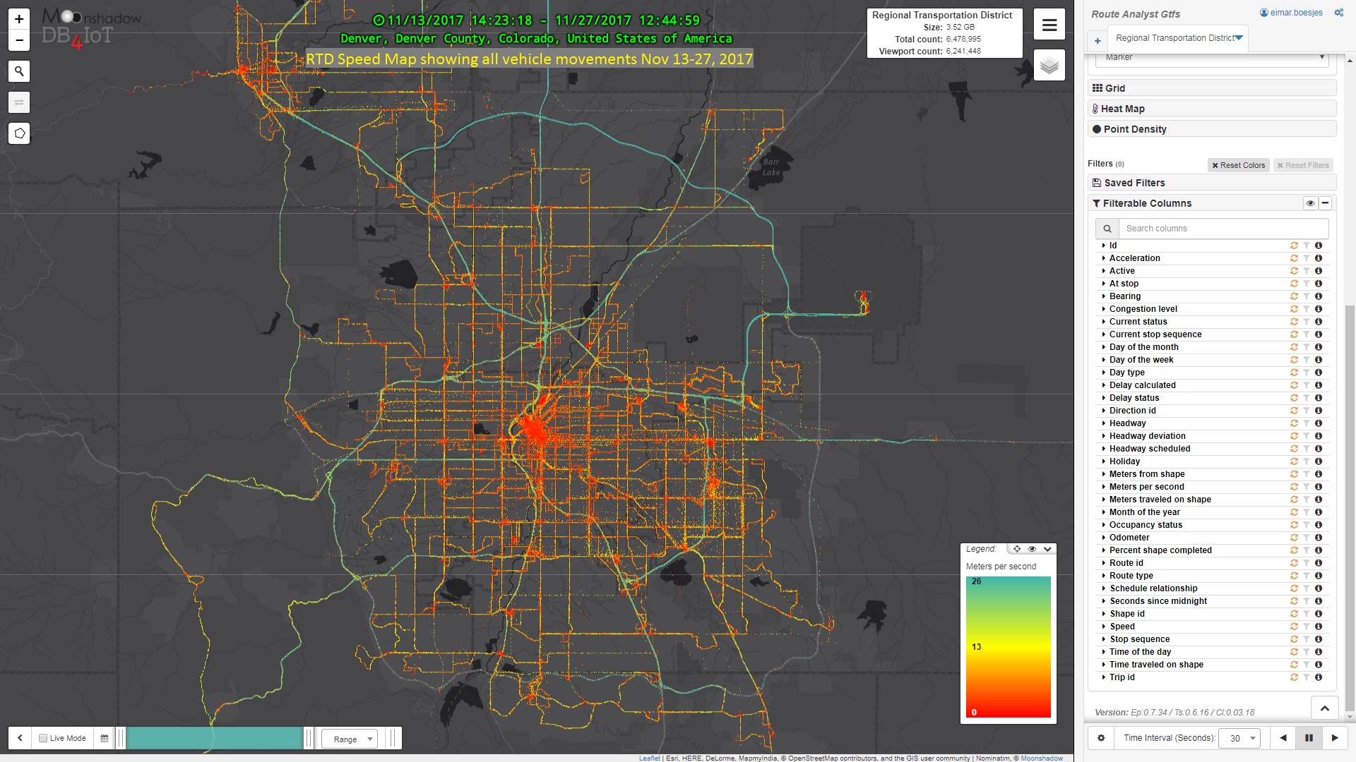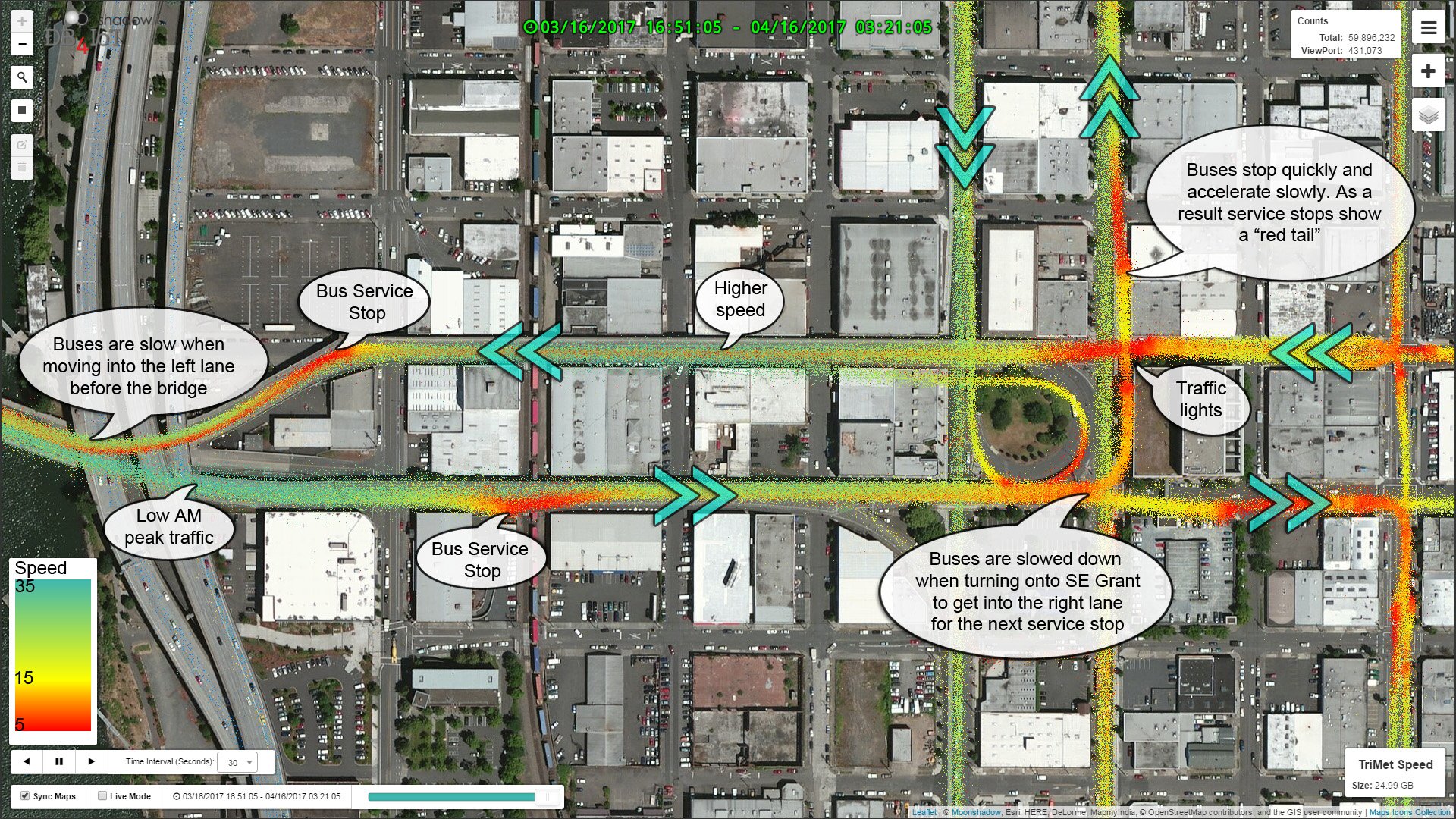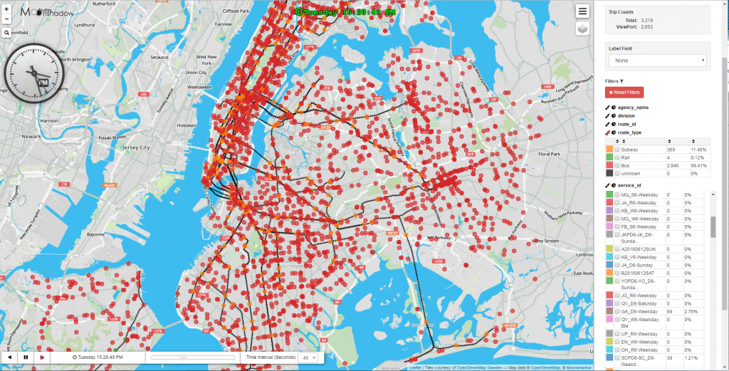
Route Analyst GTFS Released for Three Agencies in Greater Seattle Area
Route Analyst GTFS has been released for the following three agencies in the Greater Seattle area; King County Metro (KCM), Pierce County and the Washington State Ferries. KCM provides public transit throughout the greater Seattle region servicing towns from Lake Forest Park and Bothell in the North to Kirkland, Redmond and Bellevue in the East and Burien, Tukwila, Renton, Federal Way and Auburn in the South. Pierce Transit covers the greater Tacoma area and the WA State Ferries link many of the islands in the Puget Sound and in [...]